That is pretty much the story of the Pittsburgh Light Rail's 47L, Library line that runs from Washington Junction to the namesake terminus at Library, PA. Last May after my epic survey of PRR Main Line signaling I didn't just teleport home, but instead hung out with a friend at CMU and set out to cover the 47L route. Previously on
Also covered in this trip was a touristy side trip with my friend up and down the famous Pittsburgh inclined planes as well as a Wikipedia inspired visit to the steepest street in the world, Canton Avenue.
You can find the full set of photos at the usual location, but this time you have your choice of alphabetical and chronibetical order.
We begin with the University of Pittsburgh's steam plant which unlike most district heating schemes, still receives hopper cars of coal instead of some wussy fuel like natural gas. I commend Pitt's commitment to the industrial revolution.

Adjacent to the steam plant and located under the Schenley Bridge is the former CSX EAST SCHENLEY interlocking on what used to be the P&W Sub. This is the original B&O route between Pittsburgh and New Castle that winds it's way through the hills and vales of western Pennsylvania. A more direct route became available to CSX in 1993 when it bought the P&LE railroad and used their heavy duty main line along the banks of the Ohio and Beaver rivers to reach New Castle. The mostly single track P&W line was sold to a pair of short lines around 2007 and had most of its signaling system removed except for a few miles here on the east end which is the route of Amtrak's Capitol Limited between the former PRR Station downtown and the B&O main line to Washington. Currently the track is owned by the Allegheny Valley railroad, but might still be dispatched by CSX.
Here we see the eastbound CPL mast signal and some AEI scanners.

One reason the signal system was torn out was due to the ancient pole line communications system which transmits track circuit status between logic points. The relay logic CTC interlockings probably date from the 1960's.

The westbound side of the interlocking supports a hansom B&O CPL mast. The Approach Slow (2 o'clock) and Slow Approach Slow (4 o'clock) orbitals are for the Amtrak connection from FIELD interlocking to CP-BLOOM on the PRR Main Line.

Between this interlocking and the connection to CP-BLOOM is the Schenley Tunnel, which runs under the high ridge in the center of the Pittsburgh wedge. The PRR Main uses a deep rock cut that passes over the west end of this tunnel. There is a 15mph speed restriction through the tunnel which does not help the Capitol Limited. It's somewhat ironic that the Cap passes through here as I was forced to catch a 4:30am bus to get downtown just to pass by a few hundred yards from where I caught the bus!!

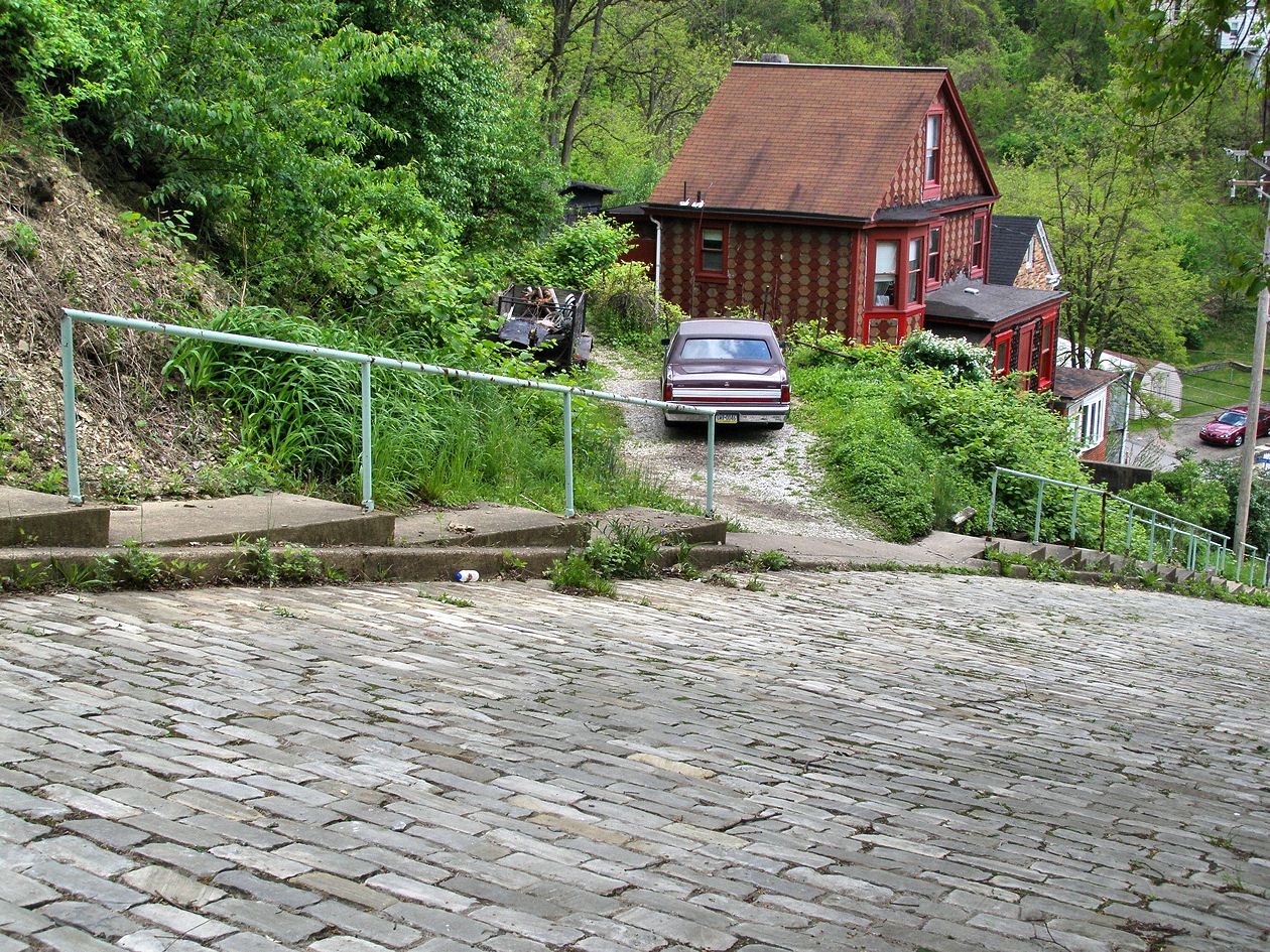
Anyway, after EAST SCHENLEY interlocking I took the 42S out to the Coast Ave stop to walk the short distance to Canton Avenue. This is no joking the steepest public street in the world with an grade of 37% The often cited steepest Baldwin Street in New Zealand maxes out at 35%, while San Francisco's steepest is a mere 31%.

The Belgian blocks that pave most of the incline are set at an angle to provide a toothed texture for extra traction. Here a local driver descends the steep grade.

One house actually has a driveway that exits out onto the steep part of Canton Ave. The grade was a result of local planners setting out the street grid without bothering to review the topology.
Since I had previously covered the 42S route I held back on taking pictures until I got to the next portion of my trip, the Pittsburgh incline planes. Getting off at Station Square I did take a picture of PAT LRV 4306.

Station square provides a transfer to the Monongahela Incline. Here one of the cars slowly descends into the base station. Because Pittsburgh uses a paper transfer based system with no day pass, this trip and all of its transfers was really starting to nickel and dime me >-:0

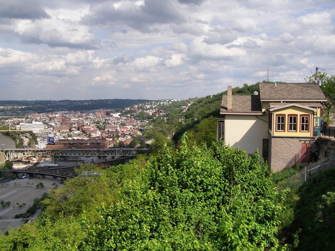
Looking down at the base station from the top with the P&LE station in the background.

The Smithfield bridge with the P&LE station.

The Monongahela Incline headhouse with the Monongahela valley in the background.
The Duquesne incline is a short walking distance from the Mon Incline. Remember not to lose your paper transfer!

The base station from above with a CSX autorack train on the P&LE main line.

The cars on the Duquesne incline are of a different design than the Mon incline.

The base station has an old timey fare booth with attendant. At the cost of a full fare the incline is pretty expensive for a glorified elevator.

Fort Pitt bridge from its pedestrian walkway. Wow, remember when bridges used to be built out of steel...and were made with rivets?


The next day I spent some time at the First Ave station killing time as I waited for a 47L direct train to Library from downtown. They travel via the recently rebuilt Overbrook Line, but service is much less frequent than either of the 42 lines.
Here is PAT #4228 on a 42S route inbound to First Ave\ with the panhandle bridge in the background.

Taking the switch onto the Overbrook line at South Hills Jct with PAT 4250 in the station.

I start my survey of the 47L as my LRV crosses the diamond at Washington Jct.

The line quickly gets very rural with stops that make me wonder why the fuck new light rail lines have to spend millions on full multi-car platforms with shelters and lights and TVM's etc.

Some locals ducking over behind our train to clear the track for an approaching 44L shuttle train.

Lots of people milling about the Hillcrest station. The ABS signaling on the line is as about as basic as it gets.

Lindermer stop. This is downright beaucholic. The tracks are PA Trolley guage of 5'2 1/4".

Lytle has been upgraded with a two-car high level platform.

The line has a surprising number of emergency crossovers.

Ample parking day or night, humble folks without temptation.

Signal 249...block lengths were about half a mile.

Some station upgrades appear to have come from Home Depot.

Rather busy picture here. From foreground to background we have the 22.9 signal, the West Library Station, a grade crossing, emergency crossover and the Sandy Creek station. Yes, the stops can be somewhat close together.

At the Library terminal we have a very impressive scissors crossover probably anticipating conversion of the line to CTC.

However until that happens the trains make use of a spring switch south of the station. Much more efficient if you ask me.

PAT 4253 pulling forward into the platform to return as a 44L shuttle. No riding out and back on a single fare :-( BTW I'm not kidding, the town is really called Library. The community was so proud after getting the first public library in the area that it decided to change its own name. Also Library was an upgrade from the previous name, Loafer's Hollow.

Letting # 4253 head back to town I caught the LRV I will eventually return on, #4306, flying past a few blocks north of the station.

Fast forward back to South Hills Jct where my plan was falling into place to catch a very rare 52 Allentowne run. Here my 2-car 47L train departs through the transit tunnel.

Our 52 Allentowne LRC #4255 on the spring switch turnback.

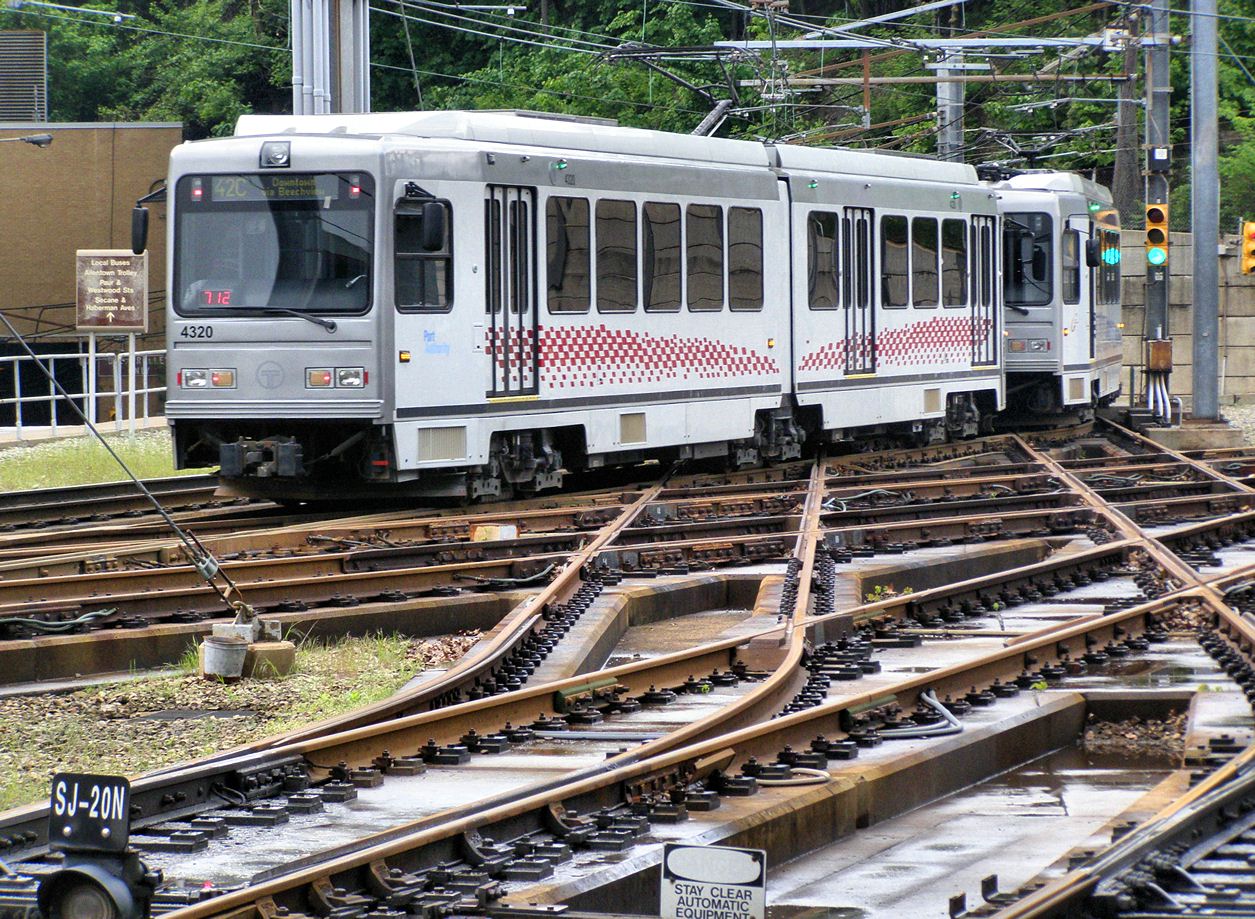
#4319 on a 42C routing crosses through the double scissors crossover at South Hills Jct.

#4320 departing on another 42C. This is the second set of consecutive cars I have seen in consecutive opposing trains on the trip.
Departing on the 52 Allentowne we see that the straight route leads from the main line to the 52, not the transit tunnel.

Departing South Hills Jct. The loop track heads off to the left.

The mainline overhead catenary cantilevers on a busy city street just looks comical to me.

Ugh, this road could use some paving.

Fortunately we had already passed the police station when the operator called me up to bitch me out for taking photos. I already reported on this previously, but basically after I asked for her employee number to verify her photo ban claims she got pissed off and began to call me a terrorist. She tried to summon the cops on me, but the control center wouldn't answer her radio calls and I simply got off at First Ave. I wrote in a complaint on her, but never bothered to read the response to maintain plausible denyability in case it contained something that failed to back up my position ;-)

Harassment aside what really pisses me off is how overbuilt today's light rail lines are. Most systems need nothing more than what you see as part of the 47L. Trolley wire, bus type stops and simple ABS could save hundreds of millions of dollars compared to the more rapid transit style lines. What ever happened to keeping things simple :-(
Anyway, that sort of marked the end of PAT photos on my trip as it started to rain shortly there after. Next time stay tuned for my photos from Amtrak's Capitol Limited as I return to the east coast.
No comments:
Post a Comment